field notes
—
Exploring matters on landscape design, practice, and preserving traditions in the contemporary world.
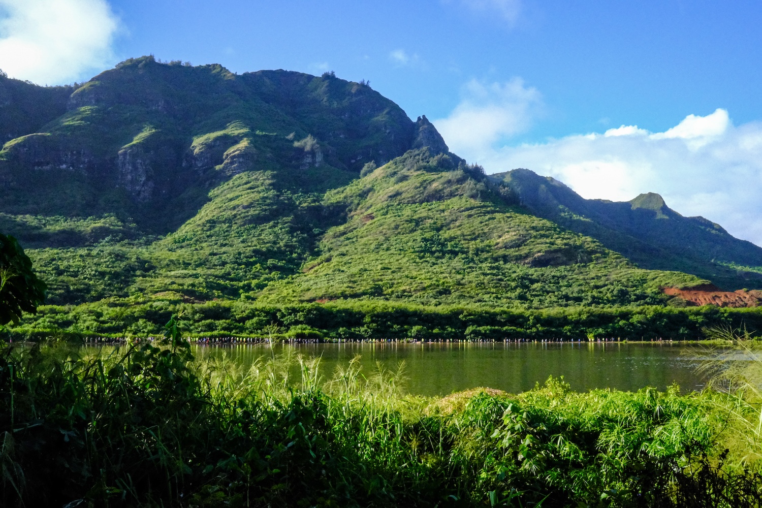
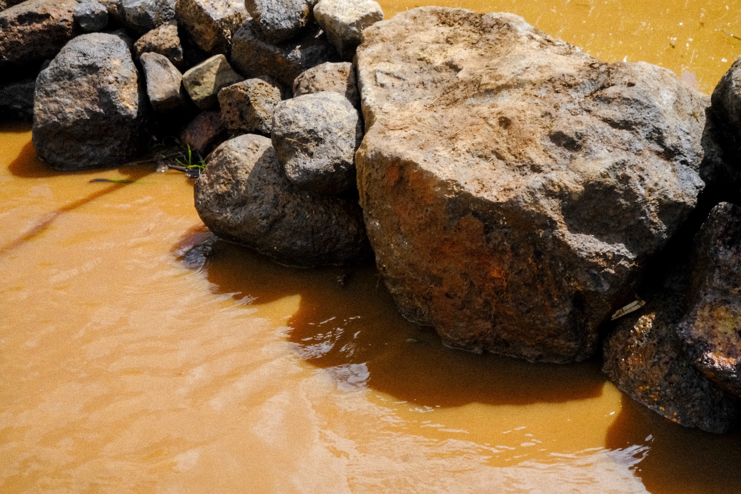

'Alekoko Fishpond

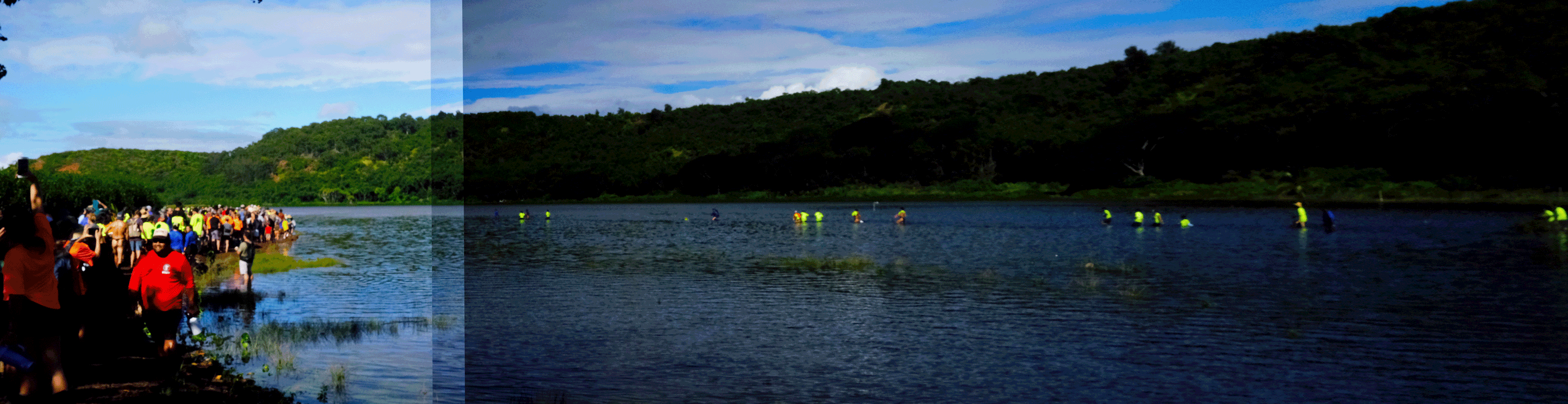
Waipā Kava Patch


'Awa Honokāne Iki
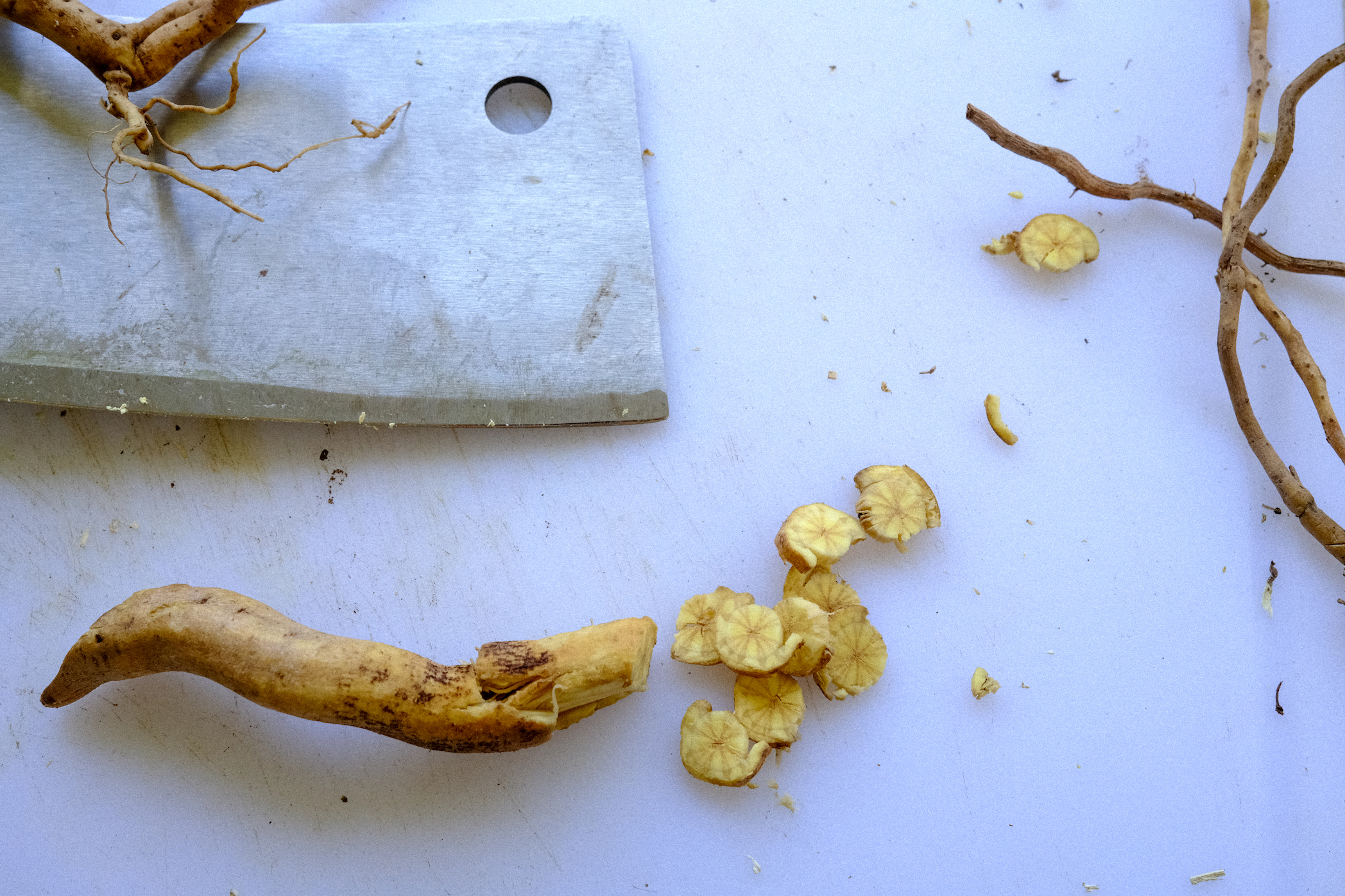
From Earth to ‘Apu: The Legacy of ‘Awa
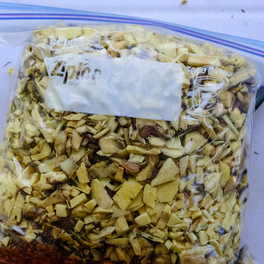
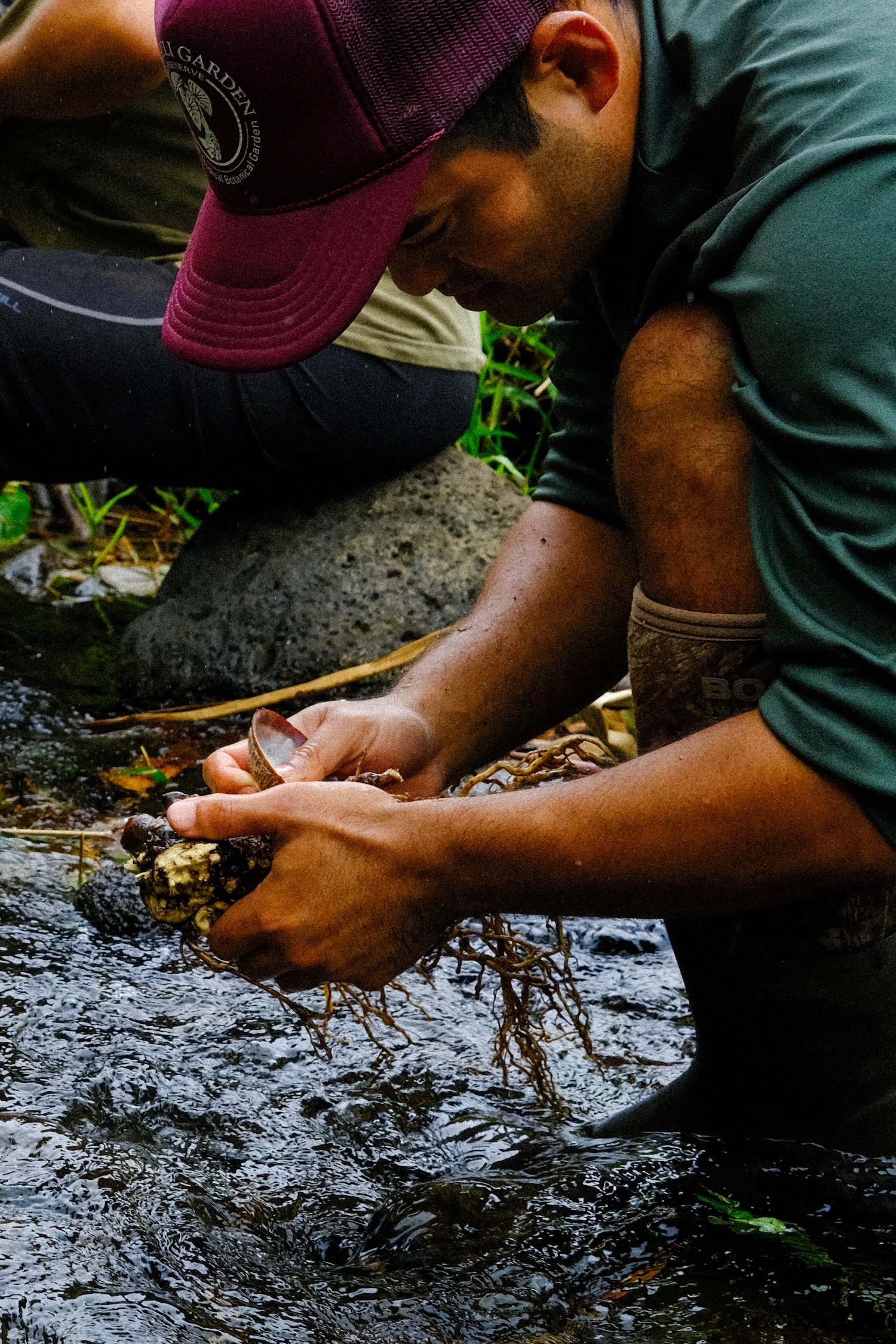
Recently, I came across some archived photographs from 2019, capturing the harvest of the 'Awa Honokāne Iki variety with Noah Kaʻaumoana. This cultivar, true to its name, originates from the rugged and remote Honokāne Iki valley in the Kohala District on the island of Hawai‘i.
For centuries, Hawaiians lived and cultivated the valleys here along Hawai’i Islands most northern coast. But after the Kohala Ditch was completed in 1906, much of the stream water was diverted to sugar cultivation. As a result, the makaʻāinana (people who tended the land) from Pololū to Honopue left their homes and farms behind.1 Without irrigation, the once-abundant populations of 'Awa Honokāne Iki dwindled.
The rediscovery of 'Awa Honokāne Iki and many of the other ‘awa cultivars can be largely attributed to one man, Uncle Jerry Konanui, a traditional Hawaiian taro and ‘awa cultivar expert. Though he described himself as only a mere farmer whos skin has been darkened by the lepo, or earth that he works within, around the Islands, Uncle Jerry is spoken of as a great and beloved man. At loss to us all, he passed away in 2017. His work as an Indigenous scientist and cultural practitioner was a driving force in reviving interest in Hawaiian crop biodiversity and cultivar recovery and identification.
Noah Kaʻaumoana, a student of student of Uncle Jerry Konanui, carries forward that legacy not just through knowledge but through action. By cultivating 'Awa Honokāne Iki, he ensures that the wisdom and traditions of his ancestors endure. The responsibility to protect, care for, and pass on this heritage is now in the hands of students like Noah, who continue to keep the culture and its stories alive.
1“’Honokāne Iki.” Hawaiian ‘Awa Views of an Ethnobotanical Treasure , Association for Hawaiian ‘Awa , Hilo, Hawaii, 2006, pp. 36–37.


‘Awa ‘Opihikao, or Spotted Hiwa
From Earth to ‘Apu: The Legacy of ‘Awa
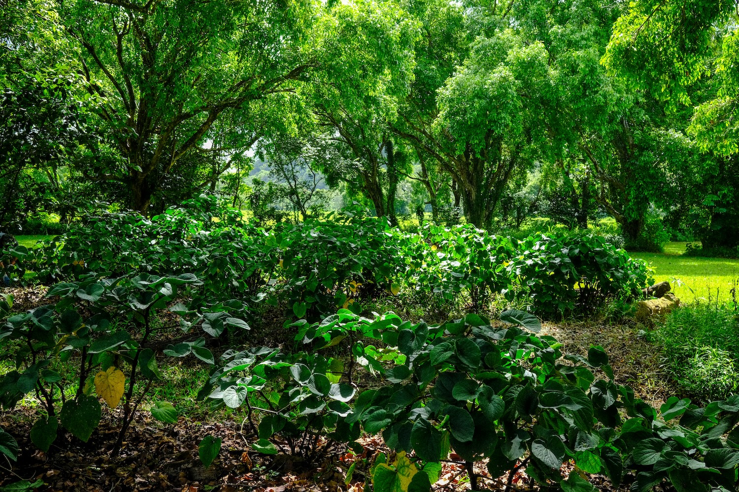
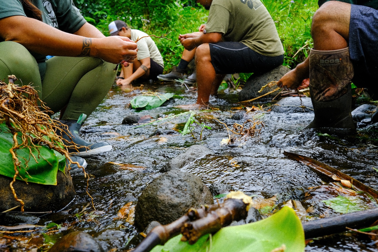
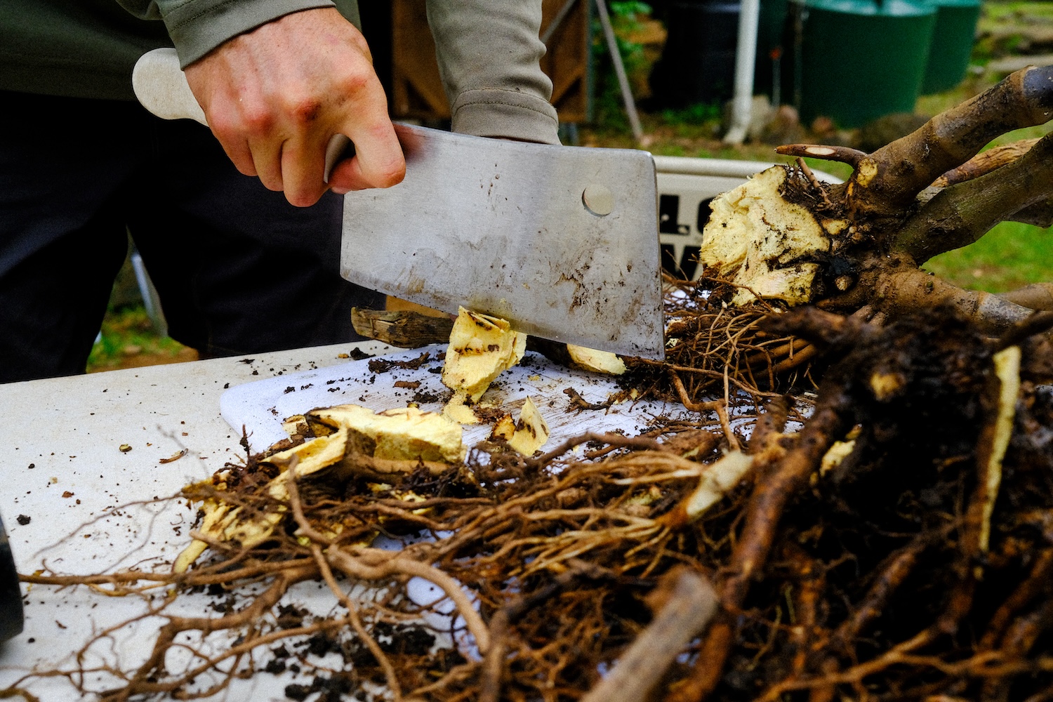
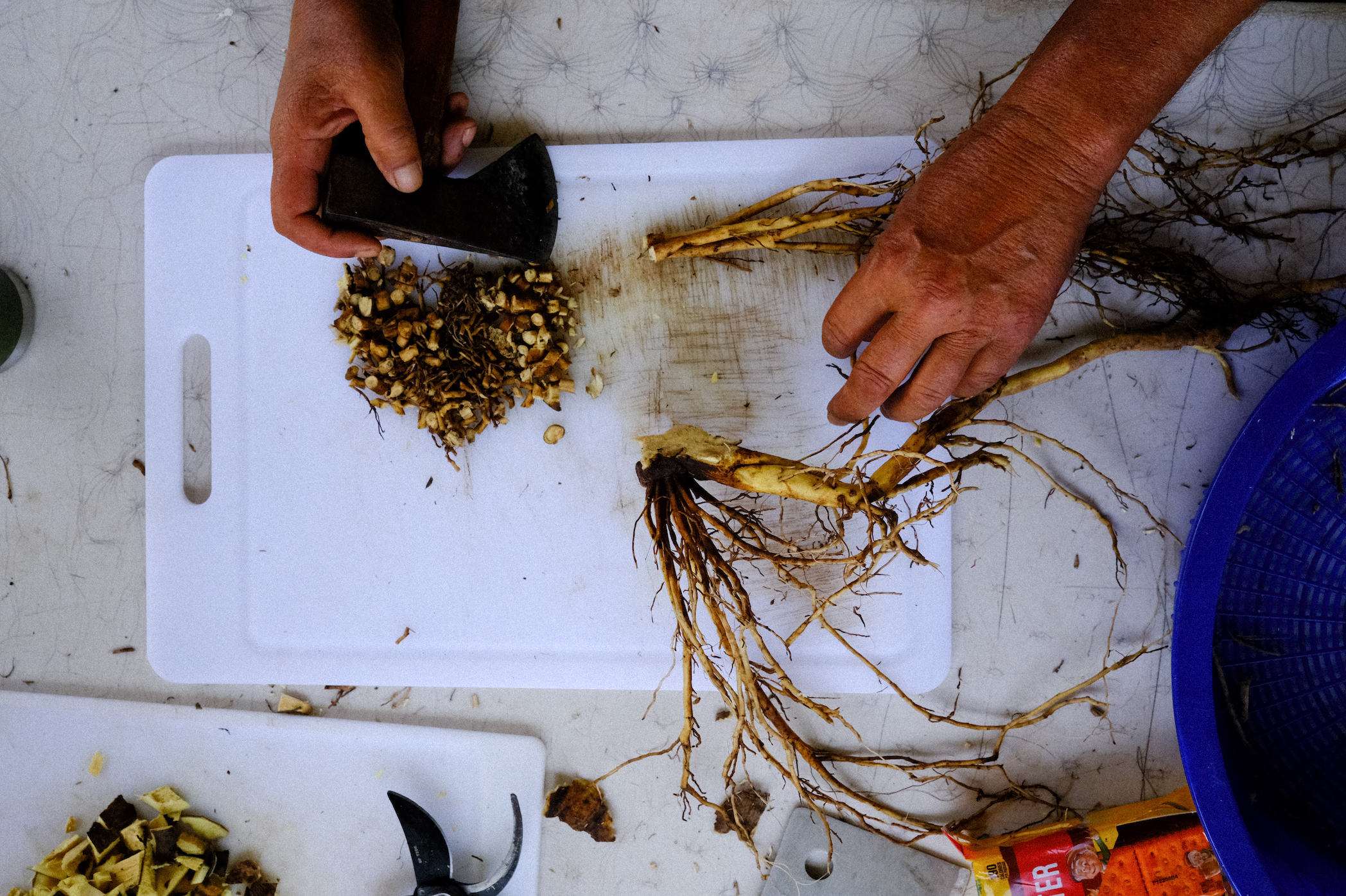
The ’awa plant, with its broad, heart-shaped leaves and sturdy, sawtooth-jointed stalks, grows quietly in the dappled shade of the mango tree. Today, our hands come to harvest.
We break ground with the ‘o‘o, or digging bar, and pry at the tethered roots. Here in Hawaii, for those of us whose lives are deeply connected to the land (ʻāina-based)—the fishermen, hunters, and farmers—’awa is an honored tradition. The scent of ‘awa, peppery and earthy, rises as we dig, each strike of the ‘o‘o reminding us of the many hands that have labored for this plant before.
‘Awa drinking, a time-honored tradition in Oceania, holds its deepest roots in Polynesia. Said to have been first planted on Kaua’i by O-ili-ku-ka-heana, it was brought from Kahiki, the ancestral homeland of all Polynesians, for use by priests in offerings to sharks1. In old Hawaiian mo’olelo (chants), ‘awa is understood as the premier food for the gods (akua and ‘aumakua). The close relationship of ‘awa to ‘aumakua, deified ancestral spirits that serve as guardians in the form of plants, animals, or natural phenomena, binds us to this familial relationship. Among the akua, the major universal gods of the Hawaiian pantheon, Pele and Kāne were particularly noted ‘awa drinkers2. When we drink ‘awa, we are partaking in a continuity that links us to these guiding spiritual forces.
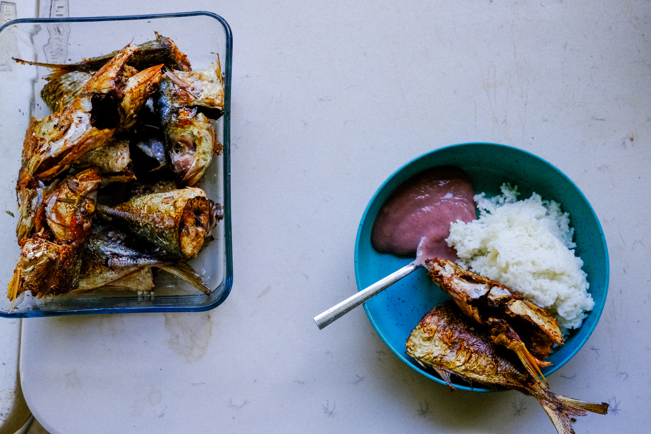
At Limahuli Garden and Preserve, the tradition of ‘awa is one that soothes our muscles and bonds us through laughter. Come pau hana, after the workday ends, we gather to drink. The bitter taste of the brew, likened to earth and mud, numbs the tongue and calms the spirit. As we sip from the husked and polished coconut shell, we feel the day’s toil slip away, the boundaries between us softening like the twilight that fades into night.
Preparing for the first annual 'Awa Festival at Limahuli has deepened this connection. This gathering, a celebration of ‘awa, will bring together growers, practitioners, and trusted enthusiasts from across the Islands. It is a time to share stories, learn from one another, and honor the diverse Hawaiian ‘awa cultivars, each with its own unique qualities and effects. The festival is a reaffirmation of landscape tradition, a moment to recognize the importance of ‘awa in our lives and in the life of our community.
The harvesting of ‘awa, which we undertake today, is of the ‘opihikao, or spotted hiwa, a variety of ‘awa with long internodes and dark-purple stalks, greatly desired for religious offerings3. With each strike of the ‘o‘o stick, the roots begin to loosen their grip on the soil. For a mature plant like this one, five years old, the roots have grown long and sinewy, making prying no easy task. Eventually, after some time, she finally gives way. Not all at once, but little by little, she releases her grasp on the earth.
The forthcoming photo series, From Earth to ‘Apu: The Enduring Legacy of ‘Awa, will capture the lead-up to the ‘Awa Festival, offering a glimpse into the relationship we have with the ‘awa plant. From tending to harvesting, from processing to enjoying, the images will tell a story of connection between people, plants, and place. As we prepare for the festival, we do so with a sense of purpose and gratitude, knowing that through ‘awa, we are not just preserving a tradition, but nurturing a bond.
1 Handy, E.S. Craighill, and Elizabeth Green Handy. “’Awa.” Native Planters in Old Hawaii, Bishop Museum, Honolulu, HI, 1972, pp. 189–199.
2 Winter, Kāwika. “Hawaiian ʻawa, Piper Methysticum: A Study in Ethnobotany.” Hawaiian ʻawa, Piper Methysticum: A Study in Ethnobotany, University Of Hawai’i, 2004, pp. 30–68.
3 “’Opihikao.” Hawaiian ‘Awa Views of an Ethnobotanical Treasure , Association for Hawaiian ‘Awa , Hilo, Hawaii, 2006, pp. 48–49.
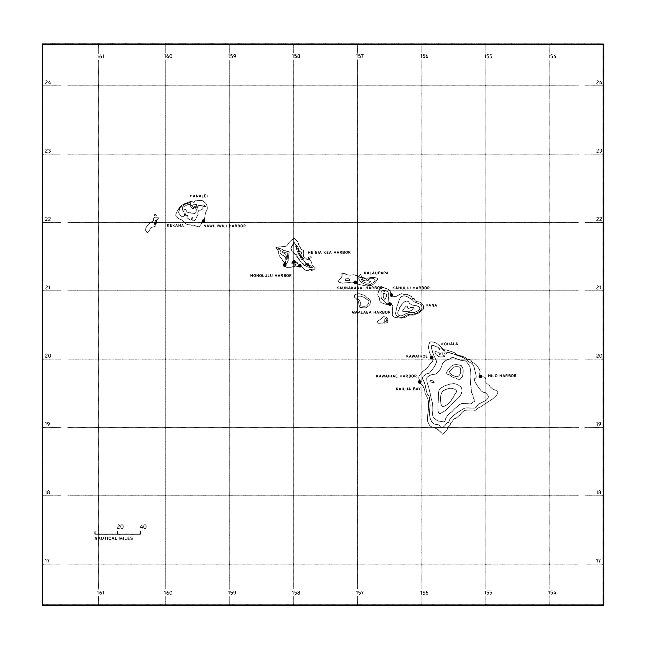
Charting Food Supply: Assessing Vessel Traffic in the Hawaiian Islands—
March 1 - 10, 2022; 12:00pm time stamp
Mapping derived from research conducted for Pōhaku, Kalo, Wai: Stewardship in Contemporary Hawai’i'.
Each day, Freight vessels (red), Commercial bottomfishing vessels (grey), and Oil tankers (black), arrive to commercial goods harbors in Honolulu, O’ahu. Cargo is then transported by tug and barge (green) to the outer islands of Kaua’i, Maui, Moloka’i, Lānaʻi, and Hawai’i.
In Hawaii, local agricultural production contributes merely 13% to the total consumable food supply. The predominant share of Hawaii's food requirements, accounting for 81%, is imported from the continental United States. An additional 6% is sourced from international markets. As for the distribution of locally produced food, 14% finds its way to the continental United States.
Loke, M.K., Leung, P. Hawai‘i’s food consumption and supply sources: benchmark estimates and measurement issues. Agric Econ 1, 10 (2013).


Acequia Chronicles: Land, Water, and Tradition 2020 Taos Land Trust Design Research Fellow
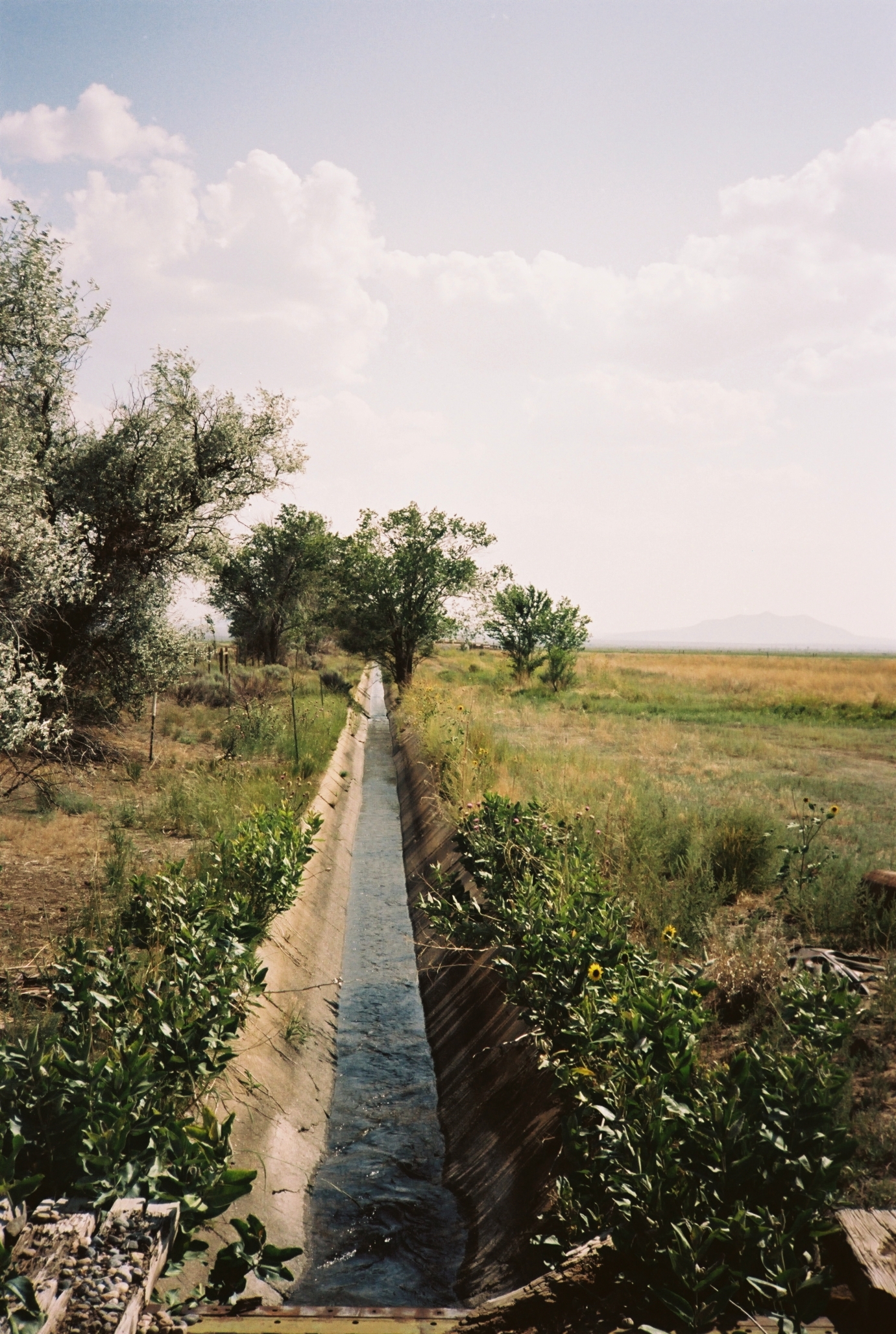
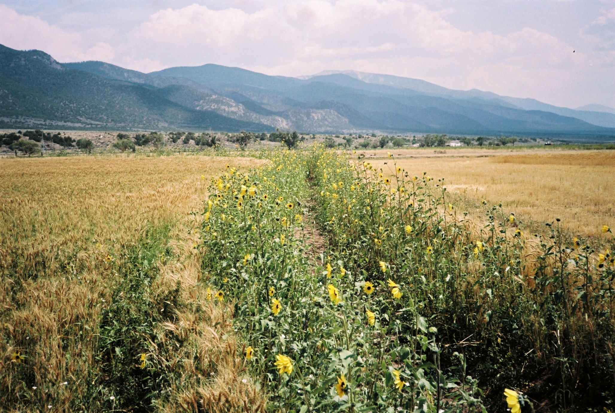
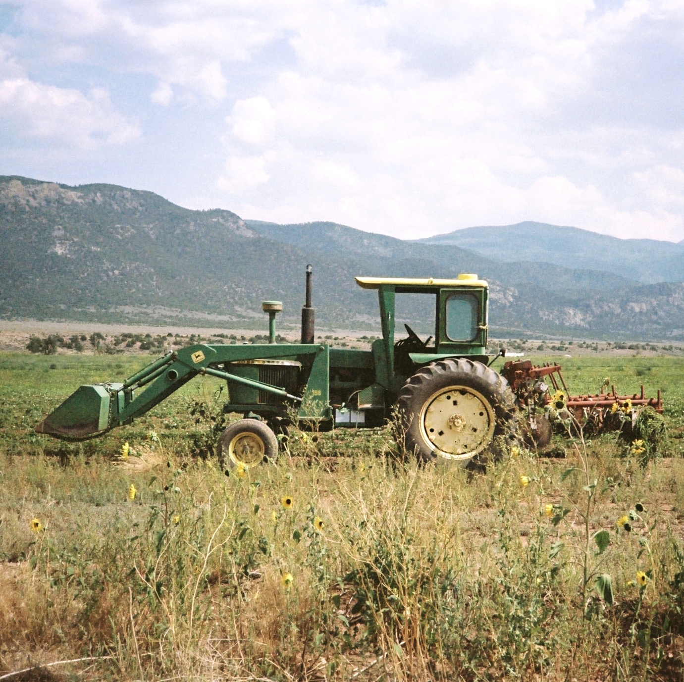
At the southernmost edge of the San Luis Valley, just over the border into New Mexico, Daniel Mutchison monitors his land and crops according to the Costilla community acequia water schedule. Here he grows wheat and snap peas. Twice a day, he floods his fields. Barley, alfalfa, clover, and other cattle fodders make up the majority share of the neighboring farms around his. Twice daily, the neighbors flood their fields too. The association ditch, paralleling the property line from north to south and poured in concrete, delivers millions of gallons of snowmelt daily to Daniel’s crops and the crops of the other ‘parciantes’ or shareholders of the acequia community.
I came to know Daniel and work on his farm in the summer of 2020, during my time as a design research fellow for The Taos Land Trust. In those months, Daniel taught me the art of disassembling and reassembling a WWII-era tractor plough, the delicate skill of setting a siphon tube, the economics of farming wheat in a region without processing facilities, and how someone in his position—an outsider—has learned to integrate with the community-managed water laws of the local acequia system.
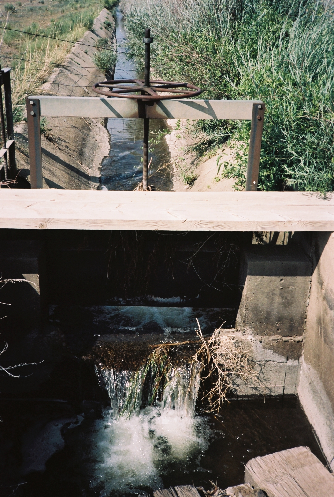
The association ditch, which Daniel depends on, is one of a dozen sangrias delivering water to farmers' fields. The parciantes, ditch-association members are responsible for the maintenance of the ditch system through a cooperative labor union known as a "limpieza."
In this sun-kissed, fiery landscape, only a few lone cottonwoods stand tall, offering a sense of scale to the epic, dusty valley. Here, the acequia system is a lifeline, interrupting the unbroken valley floor with the green of irrigated fields like Daniel’s, amidst the remnants of bygone volcanoes. For centuries, only small, Pueblo Indian and Spanish farming communities have existed here, dependent on the water their acequias provide for any chance at life.
This is an acequia system, a community-managed network of irrigation channels. The Costilla Creek diversion, featuring a system of dams and headgates known as ‘presas y compuertas,’ directs the flow of Costilla Creek into two main Acequia Madres, or ‘Mother Ditches.’ From these main ditches, gravity carries water through the system, eventually feeding into smaller, secondary canals, or sangrias—one of which supplies water to Daniel’s farm. These lateral ditches, branching off perpendicularly from the main channels, ensure that water reaches individual fields and parcels. Like fingers, these ditches spread out over the desert, causing the landscape to bloom wherever they touch.
Managed for centuries, the acequia system works in harmony with the natural water cycle, creating beauty and habitat in a landscape where otherwise only sagebrush dominates. These channels are more than just irrigation; they are the lifeblood of communities, turning the desert into a place of life, culture, and sustenance. As I learned from Daniel and the parciantes, this ancient practice continues to shape the land and the lives of those who depend on it.
I look forward to sharing more over time about the architecture of the acequia systems, their impact on the natural environment, and the rich cultural histories that have shaped these vital networks.
To learn more about acequias and the communities that sustain them, I highly recommend Mayordomo: Chronicle of an Acequia in Northern New Mexico by Stanley Crawford